Dissecting A Star Chart: Cartography Unveiled in Star Maps
In the celestial tapestry that graces our night sky, star maps stand as indispensable guides, offering a gateway to the celestial wonders that have captivated human imagination for centuries.
These intricate charts, both artistic and scientific, serve as critical tools for astronomers, navigators, and passionate sky gazers alike. But how do you read a star map? What are they composed of, and what meaning do they hold?

What is A Star Map?
At its core, a star map is a meticulously crafted visual representation of the celestial sphere, capturing the spatial distribution of stars and celestial objects as observed from a specific vantage point on Earth. This representation involves intricate calculations and precise positioning, providing a comprehensive guide to the night sky.
The historical significance of star maps cannot be overstated, with ancient cultures relying on these celestial charts for navigation, timekeeping, and mythological interpretation.
Through the lens of modern technology, star maps continue to be refined and enhanced, seamlessly blending ancient wisdom with contemporary astronomical knowledge.
Understanding Star Maps
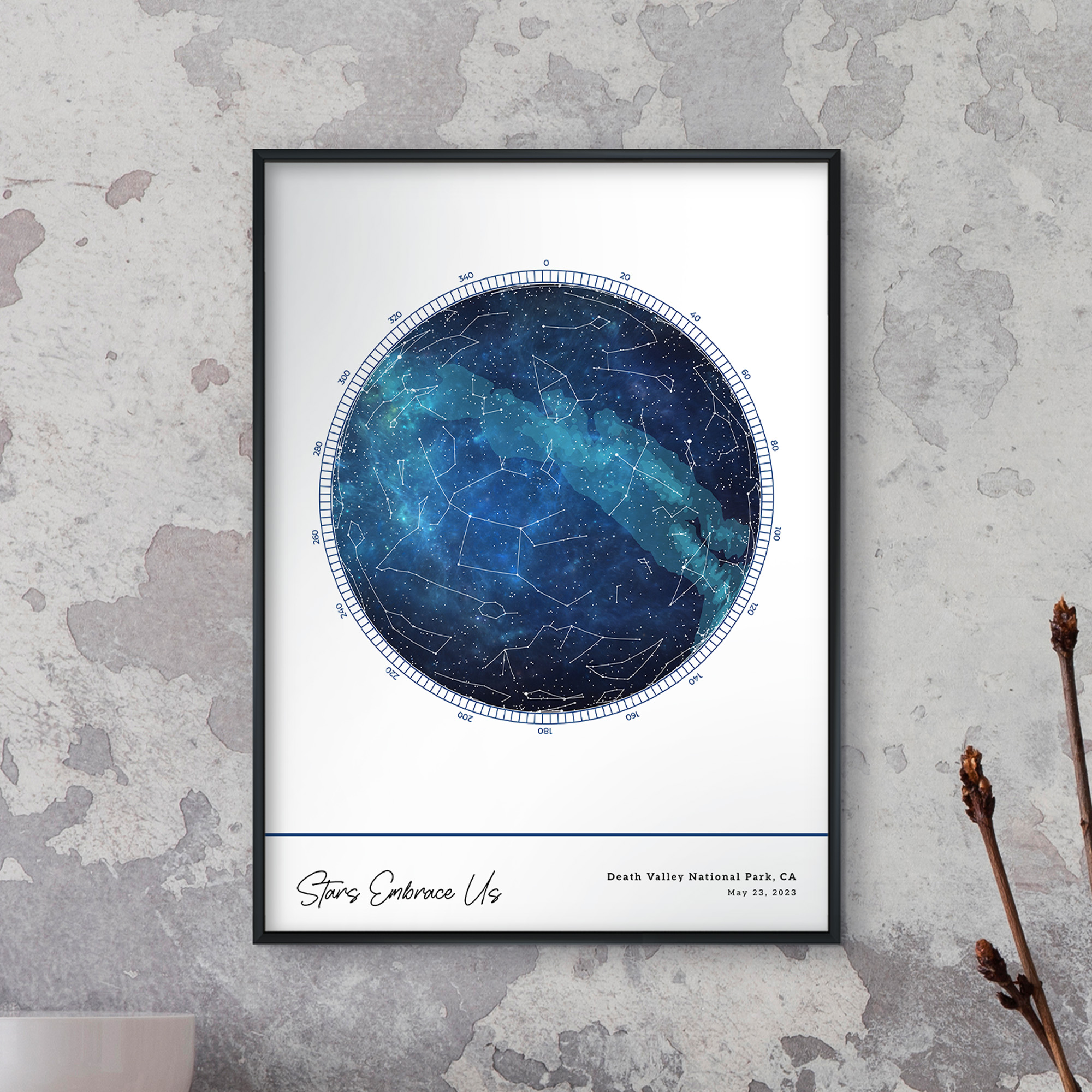
Understanding a star map involves deciphering its symbology and conventions. Stars are typically represented as points of varying size, denoting their magnitude or brightness.
Constellations, recognizable patterns of stars forming celestial images, play a central role in these maps, each with its own cultural and mythological associations.
The celestial equator, ecliptic, and other imaginary lines become essential elements, providing a framework for celestial navigation. Delving into the intricacies of a star map is not merely a scientific endeavor but an exploration of humanity's historical and cultural relationship with the cosmos.
Let’s get into it.

The Celestial Sphere
The celestial sphere, represented in a star map, serves as the backdrop against which all celestial objects are positioned. This concept involves imagining an immense, transparent sphere surrounding Earth, with stars seemingly affixed to its inner surface.
This celestial sphere provides a unified reference point for astronomers and stargazers, allowing them to pinpoint the location of celestial objects. Declination and right ascension lines on the map are direct projections of the celestial sphere's coordinates onto a two-dimensional plane.
This foundational understanding of the celestial sphere lays the groundwork for interpreting the intricate details encoded in a star map.
Constellations and Asterisms
In the vast expanse of the night sky, constellations and asterisms emerge as celestial storytelling devices, weaving intricate narratives across the cosmic canvas.
Constellations, defined patterns of stars forming recognizable shapes, have transcended their astronomical roots to become cultural and mythological symbols. They often bear names derived from ancient myths and legends, connecting humanity's collective imagination to the stars.
The identification of constellations involves recognizing these distinctive patterns, a skill honed by generations of sky watchers.
Asterisms, while closely related to constellations, represent smaller star patterns within a larger constellation or spanning multiple constellations.
These celestial jewels, like the Big Dipper within Ursa Major or the Summer Triangle comprising stars from different constellations, add an extra layer of complexity and beauty to the night sky.
The art of distinguishing constellations from asterisms requires a nuanced understanding of the night sky's intricacies, marking the convergence of scientific observation and cultural storytelling.
The study of constellations transcends the purely aesthetic; it serves as a functional tool for navigation and timekeeping. Ancient civilizations used constellations as celestial guides, helping them navigate across land and sea.
The celestial equator, an imaginary line projected onto the sky from Earth's equator, intersects with constellations along its path, further aiding astronomers in locating objects in the night sky.
The interplay of science, culture, and practical utility within the realm of constellations illustrates the multifaceted nature of our relationship with the cosmos.

Stars on the Map
Stars, the celestial beacons adorning our night sky, are meticulously plotted on a star map, each bearing its unique characteristics. The magnitude of a star, a measure of its brightness as observed from Earth, determines its representation on the map.
The classification of stars into different magnitudes enables astronomers to prioritize and study specific celestial objects. Additionally, stars exhibit a spectrum of colors, ranging from the fiery red of cooler stars to the brilliant blue-white of hotter ones.
The significance of color and brightness extends beyond aesthetics, providing valuable insights into the composition and temperature of these distant suns.
Understanding the properties of stars involves delving into the Hertzsprung-Russell (H-R) diagram, a fundamental tool in stellar astronomy. This diagram categorizes stars based on their luminosity, surface temperature, and evolutionary stage.
Stars on a star map are not just points of light but windows into the cosmic drama unfolding across the universe. The symbiotic relationship between the scientific study of stars and their representation on a star map underscores the dynamic interplay between observation and interpretation within the realm of astronomy.
Deep Sky Objects
Beyond the individual brilliance of stars, a star map introduces us to the enigmatic realm of deep sky objects, including galaxies, nebulae, and star clusters.
Recognizing and understanding these celestial entities adds a layer of complexity to the star map, transforming it into a comprehensive guide to the cosmos.
Galaxies, Nebulae, and Star Clusters
Galaxies, vast collections of stars, gas, and dust, come in various shapes and sizes, each offering a unique window into the cosmic tapestry.
Nebulae, clouds of gas and dust, exhibit stunning visual displays, often serving as stellar nurseries where new stars are born. The Crab Nebula and the Orion Nebula are iconic examples, their ethereal beauty captured on star maps for astronomers to explore.
Star clusters, tightly bound groups of stars, offer insights into the dynamics of stellar birth and evolution. The Pleiades, a prominent open star cluster, and the globular cluster Omega Centauri are celestial jewels adorning the night sky.
Symbols and notations on a star map serve as a guide to these deep sky objects, each mark representing a doorway to a specific corner of the universe. Understanding the intricacies of these symbols requires a familiarity with the morphology and characteristics of galaxies, nebulae, and star clusters.
The collaboration between astronomers and cartographers becomes evident as the celestial wonders beyond individual stars are meticulously documented and made accessible through the medium of a star map.
Grids and Coordinates
The celestial coordinate system is the backbone of precision in celestial navigation, allowing astronomers to pinpoint the location of objects on a star map with unparalleled accuracy. This coordinate system extends the familiar latitude and longitude used on Earth to the celestial sphere, providing a universal language for astronomers worldwide.
Declination, akin to latitude, measures the distance north or south of the celestial equator, while right ascension, similar to longitude, designates the angular distance eastward from a reference point.
Pinpointing Locations Using Grid Lines
Grid lines on a star map, representing the celestial coordinates, serve as a celestial GPS. These lines intersect at specific points, each corresponding to a unique location in the sky. The intersection of the celestial equator and the vernal equinox, for example, marks the point where right ascension is zero.
As astronomers navigate the celestial terrain, these grid lines become invaluable guides, enabling precise calculations of celestial positions and facilitating a shared understanding of the night sky among astronomers worldwide.
Understanding the celestial coordinate system involves conceptualizing the celestial sphere as a seamless backdrop against which all celestial objects are projected. While Earth rotates, giving rise to the changing positions of stars and celestial bodies, the celestial coordinates remain constant.
This fixed framework allows astronomers to transcend the temporal constraints of Earth's rotation and observe celestial phenomena with consistency and accuracy.
The celestial coordinate system, intricately woven into the fabric of a star map, transforms the night sky into a navigable expanse, inviting astronomers to explore the cosmos with precision.
Reading Star Map Lines
Various lines on a star map, such as the ecliptic and celestial equator, trace the celestial choreography that unfolds above us. Understanding the meaning and significance of these lines enhances our ability to interpret the celestial dance and enriches our connection to the night sky.
The ecliptic, for instance, represents the apparent path of the Sun across the sky over the course of a year. This imaginary line influences the positions of planets and other celestial bodies, marking the stage for the cosmic drama that unfolds in our night sky.
The celestial equator, an extension of Earth's equator projected onto the sky, provides a reference point for measuring declination. As celestial objects traverse this line during their apparent motion, astronomers can gauge their positions in relation to the celestial coordinates.
Understanding the ecliptic and celestial equator on a star map is akin to deciphering the intricate steps of a celestial ballet. These lines serve as guides to the positions of celestial objects, offering insights into their seasonal variations and celestial dynamics.
Additional lines, such as those marking the celestial meridian or the horizon, further enhance our ability to interpret the celestial sphere. The celestial meridian represents the line passing through the north and south celestial poles and the observer's zenith.
Objects that cross this line reach their highest point in the sky, providing optimal viewing conditions for astronomers. The horizon, on the other hand, represents the apparent boundary between Earth and the sky, influencing the visibility of celestial objects at different times of the night.
Using a Star Map
Practical tips for navigating the night sky emerge as we delve into the utility of a star map in stargazing. Beyond its role as a static representation, a star map becomes a dynamic tool for observing the ever-changing celestial panorama.
Adjusting for location and the time of year is a fundamental skill that empowers sky gazers to synchronize their earthly position with the celestial wonders above. This dynamic interaction between observer and sky adds a layer of complexity to the stargazing experience, transforming it into a personalized celestial journey.
Understanding the Earth's axial tilt, approximately 23.5 degrees, becomes crucial for accurate stargazing throughout the seasons. This tilt is responsible for the changing positions of celestial objects in the night sky, creating the familiar patterns of the zodiac and influencing the visibility of specific constellations.
By aligning a star map with the observer's latitude and accounting for the Earth's axial tilt, astronomers can predict the appearance and disappearance of celestial objects with precision.
The practical use of a star map extends beyond individual observation sessions, contributing to a deeper appreciation of the cosmic rhythms.
Celestial events such as meteor showers, eclipses, and planetary conjunctions become accessible phenomena, inviting sky gazers to anticipate and witness these celestial spectacles.
The integration of a star map into the stargazing toolkit elevates the experience from mere observation to active participation in the celestial symphony unfolding above.

The Meanings in the Stars - MixPlaces
In the ever-evolving landscape of digital advancements, MixPlaces, our groundbreaking platform, spearheads a revolutionary transformation in the realm of star mapping. We leverage the latest in technological innovations to redefine the way individuals engage with the celestial wonders above.
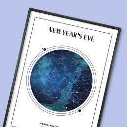
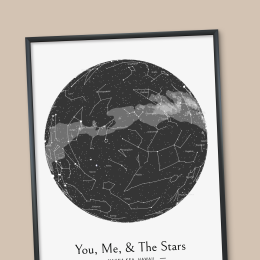
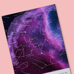
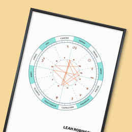
A shining example of our commitment to pushing the boundaries of celestial exploration is our unique feature that enables users to create custom star maps. Commemorating personal special events, milestones, and cherished memories, MixPlaces empowers users to craft one-of-a-kind cosmic mementos related to specific dates and locations.
By seamlessly overlaying celestial information onto the real-world night sky using top-of-the-line technologies and graphic design, we bridge the gap between the physical and virtual realms, creating an emotion-driven stargazing experience that goes beyond conventional boundaries.
All you need to do is select a time, place, and date, customize your words and aesthetics, and you’ll have a high-quality, one-of-a-kind star map special to you and your loved ones in minutes!
As MixPlaces continues to push the boundaries of innovation in the digital age, we proudly exemplify the synergy between technology and astronomy. Our platform transforms the night sky into a canvas for personal memories and milestones.
In this new era of discovery and engagement with the cosmos, MixPlaces stands as a testament to the endless possibilities that arise when cutting-edge technology meets the timeless beauty of the universe.
The cosmos, once a distant mystery, transforms into a familiar and enchanting expanse waiting to be explored. Each section of the star map unfolds as a celestial chapter, revealing the stories written across the cosmic canvas.
Whether we peer into the depths of galaxies, trace the paths of constellations, or harness the power of digital tools like MixPlaces to make the vastness of space feel more personal, our journey is a continuous exploration of the wonders that lie beyond.


