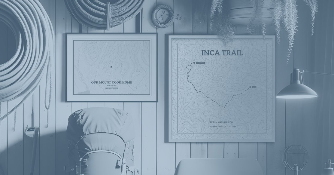
What Is A Topographic Map? A Comprehensive Guide
Topographic maps are powerful tools that provide a detailed and accurate representation of the Earth's surface.
Unlike conventional street maps, topographic maps go beyond merely indicating geographical boundaries; they meticulously illustrate the natural and man-made features of the terrain, making them invaluable for a variety of purposes.
The Evolution of Topographical Maps
The evolution of topographic mapping is a fascinating journey that spans centuries. Early civilizations used rudimentary forms of maps to depict their surroundings, but it wasn't until the late 18th century that systematic topographic mapping took root.
Contour lines, attributed to the ingenuity of the British mathematician Charles Hutton, were pioneered during his 1774 survey of the Scottish peak Schiehallion.
This table outlines the crucial developments in topographical mapping, showcasing the evolution from rudimentary techniques to the present-day highly precise methods enabled by technological advancements.
|
Time Period |
Key Developments |
Significance |
|---|---|---|
|
Early Civilizations |
Rudimentary mapping methods |
Basic depiction of surroundings |
|
Late 18th Century |
Introduction of contour lines by Charles Hutton |
Pioneering technique for visualizing terrain elevation |
|
1789 |
France's production of a comprehensive topographic map |
First complete country-wide topographic map |
|
1879 |
Establishment of the United States Geological Survey (USGS) |
Initiation of a structured and scientific approach to mapping |
|
Present Day |
Technological advancements |
Enhanced precision and detailed mapping methods |
The establishment of the United States Geological Survey (USGS) in 1879 marked a pivotal moment, leading to a more structured and scientific approach to mapping. Over time, technological advancements have transformed the way topographic maps are created and utilized, ushering in a new era of precision and detail.
Did You Know?
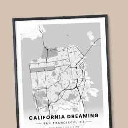
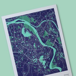
Topographic maps have a long and rich history. They have hundreds of practical applications, from helping city planners develop doable plans to aiding hikers in choosing the right path for their hiking expertise, but there’s a brand new way to use topographical maps, and it’s reached it’s peak (pun intended) right here at MixPlaces!
Topographic maps may have been strictly used for practical purposes not that long ago, but now, you can use them to frame your own memories and put them on the wall.
Whether you climbed to the top of Mount Everest or walked through the scorching sand dunes of Death Valley, you can create personalized, one-of-a-kind topographic maps that tell the story of where you’ve been, highs and lows included.
But before we get into all the incredible things you can do with a personalized topographic map, let’s learn a little more about these beautiful maps. And by “a little,” we mean everything there is to know!
What is a Topographic Map?
A topographic map is not merely a visual representation but a detailed narrative of the Earth's surface. It goes beyond the conventional map's role of indicating geographical boundaries.
Through the use of contour lines, a topographic map provides a three-dimensional portrayal of the terrain, emphasizing both natural and man-made features.
The intricacy of topographic maps lies in their ability to convey elevation changes with precision. Contour lines, spaced at regular intervals, depict the shape and elevation of the land.
This nuanced representation facilitates a deeper understanding of the landscape's topography, making topographic maps invaluable for a multitude of purposes.
Topographic Maps vs. Other Types of Maps
To comprehend the distinctiveness of topographic maps, it's crucial to contrast them with other map types. Political maps focus on administrative boundaries, delineating countries, states, and cities.
Road maps prioritize transportation networks, highlighting highways, streets, and intersections. In contrast, topographic maps stand out by prioritizing elevation and terrain details.
While political and road maps serve specific purposes, topographic maps cater to a broader range of applications. They are essential for outdoor enthusiasts, hikers, scientists, and urban planners who require detailed information about the landscape.
The USGS & Its Role in Topographic Maps
The United States Geological Survey (USGS) stands as a cornerstone in the realm of topographic mapping. Established in 1879, the USGS was tasked with systematically surveying and mapping the United States. Its mission to provide accurate and detailed maps set standards for the entire field.
The USGS played a pivotal role in advancing topographic mapping techniques and technologies. Through rigorous surveys, data collection, and continuous innovation, the USGS contributed significantly to the evolution of topographic maps.
The organization's commitment to accuracy and detail laid the groundwork for the comprehensive maps we rely on today.
The Genesis of Topographic Maps
The origins of topographic mapping can be traced back to ancient civilizations, where rudimentary maps served practical purposes.
These early maps were often driven by the need for navigation, resource identification, and territorial understanding. However, the systematic approach we recognize today emerged with the founding of the USGS.
In ancient times, maps were crafted with limited tools and resources, offering a basic yet functional representation of the surroundings. With the establishment of the USGS, a more organized and scientific approach to mapping unfolded, setting the stage for the intricate topographic maps we have today.
The USGS's Contributions Since 1879
Since its establishment, the USGS has been a driving force behind the production of topographic maps covering vast areas of the United States. The organization's journey is marked by key milestones and advancements that have shaped the field of topographic mapping.
One of the USGS's significant contributions has been the meticulous mapping of diverse terrains, from mountain ranges to coastal regions. The continuous refinement of mapping techniques and the incorporation of new technologies have ensured that USGS-produced topographic maps remain reliable and up-to-date.
Evolution of Mapping Technologies
The evolution of mapping technologies is a dynamic narrative that mirrors the progress of human ingenuity. From manual surveys and hand-drawn maps, the field has embraced cutting-edge technologies, transforming the accuracy and efficiency of topographic maps.
Manual surveys involved meticulous measurements and calculations, often constrained by human limitations. The advent of aerial photography in the early 20th century marked a significant leap forward.
Aerial surveys allowed cartographers to capture large swaths of land from above, enabling more detailed and accurate mapping.
The latter half of the 20th century witnessed a revolutionary shift with the introduction of satellite imagery. Satellites orbiting the Earth provided a bird's-eye view of the entire planet, allowing for unparalleled precision in topographic mapping.
The integration of Geographic Information Systems (GIS) further enhanced mapping capabilities, enabling the seamless incorporation of diverse data layers.
The 21st century ushered in a new era with advancements like LiDAR (Light Detection and Ranging) technology, which uses laser light to measure distances with extraordinary precision.
These technological leaps have not only refined the way topographic maps are created but have also expanded their applications across various disciplines.
Reading Topographic Maps: A Primer
Contour lines serve as the fundamental language of topographic maps, translating elevation changes into a visual narrative. These lines connect points of equal elevation, forming a continuous curve that traces the shape of the land.
Each contour line represents a specific elevation, creating a topographical contour map.
Understanding contour intervals is crucial for interpreting these lines. The contour interval represents the vertical distance between adjacent contour lines.
A smaller contour interval indicates steeper terrain, while a larger interval signifies gentler slopes. By grasping these nuances, readers can decipher the landscape's elevation changes with precision.
Deciphering Symbols and Legends
Topographic maps employ a diverse array of symbols and legends to communicate information about features like vegetation, water bodies, and cultural landmarks. These symbols serve as a visual shorthand, conveying details that enhance the map's informational richness.
Symbols may denote forests, swamps, or different types of vegetation. Water bodies are represented by symbols indicating lakes, rivers, or marshes. Cultural features like buildings, roads, and railroads are also symbolized.
Legends accompanying topographic maps provide a key to interpreting these symbols, ensuring readers can extract meaningful insights from the maps.
Understanding Map Scale and Resolution
The scale of a topographic map is a critical factor in accurately representing the relationship between the map and the actual terrain. Map scale is expressed as a ratio or a representative fraction, indicating the proportional size of features on the map compared to their actual size on the ground.
Choosing an appropriate scale depends on the intended use of the map. Large-scale maps, such as 1:24,000, provide detailed information over a smaller area, making them suitable for hiking and local planning, but we’ll dive deeper into that later.
Small-scale maps cover larger areas with less detail, making them useful for regional planning or understanding broader geographic patterns.
Resolution refers to the level of detail captured in a map. High resolution allows for finer details, while lower resolution provides a more generalized overview. Understanding both scale and resolution is essential for selecting the right map to meet specific informational needs.

The Anatomy of a Topographic Map
Topographic maps contain a plethora of features that collectively provide a comprehensive understanding of the landscape. These features are categorized into natural and man-made elements, each contributing to the map's richness.
Natural features encompass geological formations like mountains, valleys, rivers, and lakes. Understanding the representation of these features aids hikers, geologists, and researchers in navigating and studying the terrain.
Man-made features, on the other hand, include roads, buildings, and urban areas, offering insights into human infrastructure and development.
Interpreting Natural Features: Mountains, Valleys, Water Bodies
Interpreting natural features on a topographic map requires an understanding of how contour lines depict the landscape's relief.
Mountains are represented by concentric rings of contour lines, with the innermost lines indicating higher elevations. Valleys are characterized by contour lines converging towards a central line, while rivers and lakes are shown through contour lines encircling the water body.
Differentiating between these natural features enables users to visualize the terrain accurately. This interpretation is vital for outdoor enthusiasts planning hikes, scientists studying ecosystems, and land managers assessing conservation areas.
Interpreting Man-Made Features: Roads, Buildings, Urban Areas
Man-made features depicted on topographic maps provide insights into human activities and infrastructure. Roads are represented by thin lines, varying in width based on their classification.
Buildings are often symbolized by small squares, while urban areas are indicated by a concentration of structures and roads.
Understanding the representation of man-made features is essential for urban planners, architects, and engineers. It aids in assessing the layout of cities, planning transportation networks, and evaluating the impact of human development on the landscape.
Topographic Map Series and Scales
Topographic maps are available in various scales, each designed to meet specific mapping needs. The scale of a map defines the level of detail it provides, with larger scales offering more detailed information over a smaller area.
For detailed exploration, a large-scale map, such as 1:24,000, is suitable. These maps provide intricate details for activities like hiking, where knowledge of the terrain's nuances is crucial.
Medium-scale maps, like 1:100,000, offer a balance between detail and coverage, making them useful for regional planning. Small-scale maps, such as 1:250,000, cover broader areas with less detail, serving purposes like national planning or understanding large-scale geographic patterns.
The Standard Scale (1:24,000) and Its Significance
The 1:24,000 scale is a standard for many topographic maps, especially in the United States. This scale strikes a balance between detail and coverage, making it widely adopted for various applications.
It is particularly popular for recreational activities like hiking and orienteering, providing sufficient detail for navigating diverse terrains.
The significance of the 1:24,000 scale lies in its ability to offer a granular view of the landscape while maintaining practical coverage. This makes it a go-to choice for outdoor enthusiasts, researchers, and planners alike.
Special Considerations for Alaska and Non-Standard Scales
Alaska's unique geographical challenges necessitate special considerations in topographic mapping.
The vast and rugged terrain, coupled with extreme weather conditions, demands specialized mapping approaches. Non-standard scales may be employed to accommodate the intricacies of Alaska's landscape, providing detailed information tailored to the region's specific needs.
Non-standard scales are also utilized in specific contexts where a customized level of detail is required. These scales cater to unique mapping requirements, ensuring that topographic maps effectively serve their intended purposes.
Using Topographic Maps: Practical Applications
Topographic maps are indispensable tools for navigation and orienteering, providing detailed information for effective route planning. Understanding contour lines allows users to visualize elevation changes, helping hikers and outdoor enthusiasts navigate diverse terrains.
Orienteering, a sport that combines navigation and racing, heavily relies on topographic maps. Participants use these maps to navigate through checkpoints, honing their ability to interpret contour lines, symbols, and scale.
It’s true that the precision offered by topographic maps enhances the safety and enjoyment of outdoor activities, but topographic maps have more practical uses than you could even imagine.
Environmental Science and Land Management
In environmental science and land management, topographic maps play a pivotal role in decision-making. These maps provide essential information for assessing ecosystems, identifying sensitive areas, and planning conservation efforts.
Scientists studying biodiversity, land managers overseeing protected areas, and conservationists working to preserve natural habitats all utilize topographic maps.
Topographic maps aid in understanding the relationships between terrain features, guiding sustainable land-use planning and contributing to the preservation of ecosystems.
Urban Planning and Construction
Urban planning and construction projects leverage topographic maps to ensure well-designed and sustainable development. These maps offer insights into the existing landscape, guiding planners in making informed decisions about infrastructure, transportation networks, and land use.
Architects and engineers use topographic maps to assess elevation changes, plan drainage systems, and consider the impact of human activities on the terrain. The detailed information provided by these maps enhances the efficiency and sustainability of urban development projects.
Acquiring Topographic Maps
In an online world, accessing existing topographic maps has never been easier. In this modern era, where information is readily available online, obtaining topographic maps is (literally) as easy as the click of a button.
To find an existing topographic map of an area, all you need to do is hop on your internet browser and type in the location you wish to find followed by the words “topographic map.” You’ll immediately see thousands of results. It’s as simple as that!
Once you find an image you like, you can download it to your device and use it as you see fit. Some places will allow you to order physical copies, likely for a price, and if you so choose, you can purchase your physical print and await its delivery.
We, however, can't speak to the quality of other mapmakers. Because the online market is now oversaturated, you could come across unreliable sellers pushing low-quality or inaccurate prints. When you create your own topographic map with us at MixPlaces, two things are guaranteed, among many others:
-
Our maps are accurate, high-quality, and long-lasting.
-
You can personalize the color, texts, and feel of your map to match your personal or home aesthetic to a T.
That said, one other option to purchasing a digital or physical map print that’s accurate does exist: buying it directly from the USGS.
Utilizing the USGS Map Store
Government entities, such as the United States Geological Survey (USGS) and similar agencies in other countries, often provide a centralized repository for topographic maps. These websites typically offer user-friendly interfaces, allowing users to browse, search, and download maps seamlessly.
-
USGS National Map: The USGS National Map is a comprehensive resource that allows users to explore and download topographic maps of the United States. The website features an intuitive interface, enabling users to specify the area of interest and choose from various map layers.
-
National Mapping Agencies: Many countries have their own national mapping agencies that provide topographic maps. These agencies often offer online platforms where users can access and download maps. The availability of digital formats enhances the convenience of acquiring these maps.
How to Order Physical Copies
For enthusiasts who prefer tangible maps, ordering physical copies remains a viable option. While the digital age has transformed map accessibility, physical maps continue to be relevant for certain applications, such as navigation in remote areas without reliable digital connectivity.
Here's a comprehensive guide on obtaining printed topographic maps:
-
Government Map Stores:
-
USGS Map Store: The USGS operates a dedicated map store where users can order printed topographic maps. This service allows individuals to choose specific maps and have them delivered to their doorstep. The store often provides customization options, such as selecting the paper type and print scale.
-
National Mapping Agencies: Similar to digital maps, national mapping agencies often offer services for ordering physical maps. These agencies may have online platforms where users can browse available maps and place orders.
-
-
MixPlaces:
-
E-commerce platforms, such as MixPlaces, often have a selection of topographic maps available for purchase. Users can explore different editions, scales, and regions, and have the maps delivered to their location.
-
Here, however, we take it a step further. We not only sell pre-made topographic maps of popular topographies around the world, such as mountains and valleys, we also give you the option to create your own topographical map, accentuating the exact area you want printed down to the inch!
-

Naming Conventions of Topographic Maps
The naming conventions of topographic maps play a crucial role in identifying specific maps and their geographical coverage.
Understanding how these names are assigned provides insights into the organization and categorization of maps, contributing to an efficient and systematic approach to map usage.
-
Geographical References:
-
Location-Based Names: Many topographic maps are named based on the geographical features or prominent landmarks within their coverage area. For example, a map covering a region with significant mountain ranges may be named after those mountains.
-
Water Bodies: Maps may also be named after prominent water bodies, such as rivers, lakes, or seas, that are central to the map's coverage. This naming convention aids in quickly identifying the general area covered by the map.
-
-
Administrative Boundaries:
-
Political Divisions: In some cases, topographic maps are named after political or administrative divisions, such as states, provinces, or counties. This naming convention helps users associate the map with specific political jurisdictions.
-
National Parks and Reserves: Maps covering areas within national parks or reserves may be named after the protected area. This provides a clear indication of the map's focus on a specific natural or recreational space.
-
-
Map Scale and Series:
-
Scale-Based Names: The scale of a topographic map, such as 1:24,000, often influences its name. Maps with the same scale may have different names based on their coverage area. This allows users to quickly identify the level of detail offered by a specific map.
-
Series Identification: Topographic maps are often organized into series, each covering a specific region or scale. The series name, such as the 7.5-minute quadrangle series, is incorporated into the map's name, providing additional context about its characteristics.
-
-
Specialized Maps and Themes:
-
Thematic Focus: Some topographic maps are named based on their thematic focus. For example, a map emphasizing geological features may include terms like "geological" or "geologic" in its name. This helps users identify maps with specific information.
-
Special Features: Maps highlighting unique features, such as trails, landmarks, or historical sites, may include descriptors in their names. This assists users in choosing maps that align with their specific interests or activities.
-
How Topographic Maps Are Named
Topographic maps are typically named based on prominent geographical features within the designated area. These features can range from prominent mountains and rivers to distinctive landmarks or human-made structures.
The objective is to provide a name that reflects the essence of the depicted landscape, aiding users in quickly identifying and associating the map with a specific region.
The naming process often involves collaboration between cartographers, geographers, and local authorities familiar with the area. This ensures that the chosen name resonates with the geography and cultural context of the region, enhancing the map's relevance to those who rely on it.
Importance of Clear Nomenclature
Clear and meaningful names significantly enhance the identification and usability of topographic maps. When users glance at a map title, it should immediately convey essential information about the covered area.
A well-chosen name facilitates quick decision-making, especially in scenarios where time is critical, such as during outdoor navigation or emergency response.
Moreover, clear nomenclature contributes to the accessibility of maps for diverse users, including researchers, hikers, urban planners, and emergency services.
It creates a standardized system that transcends language barriers, allowing individuals from different linguistic backgrounds to easily interpret and utilize the information provided by the map.
In essence, the significance of naming conventions goes beyond mere labeling; it serves as a cornerstone for effective communication through maps. Users can rely on these names to orient themselves spatially, plan activities, and collaborate on projects that require a shared understanding of geographic locations.
Indexes and Finding Your Way Around
Indexes play a crucial role in efficiently locating specific topographic maps within a series or region. Understanding how to navigate these indexes is key to streamlining the map retrieval process.
Indexes are often presented in a grid format, dividing the mapped area into manageable sections. Each section is assigned a unique identifier, usually based on a coordinate system or alphanumeric code. Users can refer to the index to determine the specific grid or section where their area of interest is located.
To find a specific map, users start by identifying the relevant grid or section on the index. Once located, they can cross-reference this information with the map series to pinpoint the exact map sheet they need.
This systematic approach ensures a methodical and organized way of locating maps, whether in physical archives or digital repositories.
Interactive Tools and Online Viewers
The evolution of technology has introduced interactive tools and online viewers, revolutionizing the way users explore and interact with topographic maps.
Online platforms often provide interactive map viewers that allow users to zoom in and out, pan across the landscape, and overlay additional layers of information.
These layers may include satellite imagery, terrain elevation, and even real-time data such as weather conditions or traffic patterns. Interactive tools enhance the user experience by providing dynamic and customizable views, catering to a diverse range of needs and preferences.
The utilization of grid systems in interactive tools further facilitates precise navigation. Users can toggle between grid views, click on specific grid sections, and instantly access the corresponding map sheets.
This level of interactivity enhances the efficiency of map exploration, making it a valuable resource for professionals, enthusiasts, and researchers alike.
Comparing Historical and Modern Topographic Maps
Historical topographic maps, often created through manual surveying methods, provide a snapshot of the past. These maps may have limitations in terms of accuracy and detail compared to their modern counterparts.
The cartographic techniques employed in historical maps, such as manual contouring and hand-drawn symbols, reflect the technology available at the time of their creation.
On the other hand, US Topo maps, produced with the aid of advanced technologies like Geographic Information Systems (GIS) and satellite imagery, offer unparalleled precision and detail.
The use of digital tools allows for more accurate elevation data, automated contour generation, and the integration of real-time information. Modern maps also benefit from standardized symbols and legends, enhancing consistency and clarity for users.
Understanding the Impact of Technological Advancement on Mapping
Technological advancements have played a pivotal role in reshaping the field of topographic mapping. The transition from manual survey methods to the integration of satellite imagery, GIS, and digital cartography has revolutionized the accuracy, efficiency, and accessibility of maps.
The impact of technology is evident in the increased precision of elevation data. Satellite-based systems, such as LiDAR and GIS, enable the creation of highly detailed and accurate elevation models.
The use of digital tools has also facilitated the production of up-to-date maps. Real-time data feeds, such as weather conditions, traffic patterns, or land-use changes, can be incorporated into digital maps, ensuring that users have access to the latest information.
Keeping Up-to-Date: Map Updates and Revisions
Ensuring the accuracy and relevance of topographic maps requires a systematic approach to updates and revisions. Understanding the production cycle of US Topo maps and their update frequency is essential for users who rely on the latest geographic information.
The production cycle of US Topo maps involves several stages, beginning with data collection and validation. Geographic data is collected from authoritative sources, including aerial surveys, satellite imagery, and ground-based measurements.
The frequency of updates and revisions depends on factors such as the rate of landscape changes, technological advancements, and the availability of new data.
Critical updates may occur more frequently, especially in areas experiencing rapid development or environmental changes. The USGS strives to maintain a balance between providing the latest information and ensuring the accuracy of the maps.
Revising and updating topographic maps is a complex and meticulous process that involves multiple steps to guarantee the accuracy of the information presented.
Collecting New Information
New information, whether it's changes in elevation, land cover, or infrastructure, is systematically collected and validated using surveying techniques, remote sensing technologies, and collaboration with relevant authorities to obtain the most accurate and current data.
Validation
Validation is a critical step in ensuring the reliability of the collected data. Rigorous quality control measures are applied to identify and rectify any discrepancies or errors. This involves cross-referencing new data with existing datasets, conducting field surveys when necessary, and leveraging technological tools for data verification.
Integration
Integration is the phase where the revised data is seamlessly integrated into the existing map framework. Advanced cartographic techniques are employed to update elevation contours, symbols, and other map elements. The goal is to create an accurate representation of the landscape.
Review and Approval
Review and approval involve a thorough examination of the updated map by cartographic experts, geographers, and relevant stakeholders. This collaborative review ensures that the revised map meets established standards for accuracy, clarity, and consistency.
Once approved, the updated map is ready for distribution to the public.
Technical Aspects and Innovations in Topographic Mapping
Georeferencing is a fundamental aspect of modern topographic mapping, ensuring that maps align accurately with the Earth's surface. This technical process involves associating geographic coordinates (latitude and longitude) with specific points on the map, enabling precise spatial referencing.
The significance of georeferencing lies in its ability to establish a standardized coordinate system for maps. This ensures consistency in spatial relationships, allowing users to overlay multiple maps seamlessly and integrate diverse geospatial datasets.
Advancements in georeferencing technologies, including the use of GPS (Global Positioning System) and satellite-based positioning systems, have enhanced the accuracy of mapping. These technologies enable surveyors to pinpoint geographic coordinates with unprecedented precision and reliability.
GIS Data Integration in Modern Topographic Maps
GIS facilitates the overlay of multiple data layers on a single map, enabling users to explore relationships between different spatial elements. This integration enhances the analytical capabilities of topographic maps, supporting a wide range of applications, from environmental planning to disaster management.
The use of GIS also enables the creation of customized maps tailored to specific user needs. By selecting and combining relevant data layers, users can generate maps that emphasize particular features or highlight specific characteristics of the landscape.
The accessibility of GIS technology has further democratized map creation and analysis. Users with varying levels of expertise can leverage user-friendly GIS software to explore, manipulate, and interpret geographic data.

Advancements in Cartography and Mapping
The field of cartography and mapping continues to advance, incorporating innovative technologies that enhance the visualization and communication of geographic information. These advancements contribute to the evolving landscape of topographic mapping, shaping the way users perceive and interact with spatial data.
3D Visualizations
One notable innovation is the integration of 3D visualization techniques. Traditional topographic maps, represented in two dimensions, have been augmented with three-dimensional renderings of the terrain.
This enhancement provides users with a more immersive and realistic portrayal of the landscape, aiding in better spatial comprehension.
Augmented Reality
Augmented reality (AR) is another cutting-edge development in cartography. AR technology overlays digital information onto the user's physical surroundings, creating an interactive and dynamic mapping experience.
In the context of topographic maps, AR can be utilized to provide real-time data overlays, enhancing situational awareness for users in the field.
Artificial Intelligence
As technology continues to evolve, the intersection of cartography with fields such as artificial intelligence (AI) and machine learning holds promise for further innovations.
AI algorithms can potentially assist in automating certain aspects of map creation and analysis, streamlining processes and increasing efficiency.
Cartographic Design
Advancements in cartographic design have also played a role in enhancing the clarity and interpretability of topographic maps. The use of standardized symbols, color-coding, and intuitive legends ensures that users can quickly grasp key information on the map.
These design principles contribute to effective communication and facilitate a seamless user experience.
Accessibility of Topographic Maps
The transition to digital formats has revolutionized the accessibility of topographic maps, offering users a range of advantages that enhance their utility and convenience.
Digital formats provide portability, allowing users to carry a vast collection of maps on portable devices such as smartphones or tablets. This portability is especially valuable for outdoor enthusiasts, hikers, and researchers who may need to reference maps in various locations.
How to Use Geospatial PDFs
Geospatial PDFs represent a seamless blend of traditional map formats with modern digital features, providing users with a versatile and interactive mapping experience. Understanding how to navigate and utilize geospatial PDFs is essential for fully harnessing their capabilities.
Geospatial PDFs retain the familiar look of traditional paper maps but come enriched with georeferenced data and interactive features. Here are a few key aspects to consider when using geospatial PDFs:
-
When using geospatial PDFs, navigation is a key aspect of the user experience. Users can zoom in and out, similar to a regular PDF, but the geospatial aspect enables more sophisticated navigation.
-
One of the standout features of geospatial PDFs is the ability to interact with different layers of information. Layers can include elevation contours, land cover, or specific points of interest. Users can toggle these layers on and off, customizing the map to display only relevant information.
-
Many geospatial PDF readers offer geolocation features, allowing users to pinpoint their own location on the map using GPS data. This real-time integration enhances the usability of geospatial PDFs for activities like hiking or field research, where knowing one's precise location is essential.
-
Geospatial PDFs often support hyperlinks and multimedia elements, enriching the user experience with additional context and information. Hyperlinks can provide more details about specific features on the map. Multimedia elements, such as images or videos, can offer a multimedia-enhanced exploration.
-
For users who wish to personalize their maps or make notes for future reference, geospatial PDFs typically offer annotation and marking features. These tools allow users to add text, symbols, or drawings directly onto the map, creating a customized experience tailored to their specific needs.
-
Geospatial PDFs can facilitate the sharing of annotated maps and collected data. Users can collaborate in real-time, adding comments or annotations that are visible to others viewing the same PDF.
The Future of Topographic Mapping: What’s Next?
Anticipating changes in the production cycles of topographic maps provides valuable insights into the future landscape of mapping. As technology continues to advance, the traditional approach to map creation and dissemination is likely to undergo transformative shifts.
Advancements in data collection methods, such as improvements in satellite technology and aerial surveys, may lead to more frequent and detailed updates in topographic maps.
The integration of real-time data feeds, AI, and machine learning could further enhance the efficiency of map production, ensuring that users have access to the latest and most accurate information.
Trends and Future Directions in Topographic Mapping: Welcome to MixPlaces!
In the ever-evolving landscape of topographic technology, MixPlaces has emerged as a trailblazer in the realm of customized maps, providing users like yourself with the ability to transform their outdoor adventures into personalized experiences.
We understand that every adventure is unique, and so should be the maps that guide them. Users have the freedom to select from a spectrum of colors to represent elevation, water bodies, and other geographical features.
Whether it's a serene blue for lakes or a daring red for mountainous terrains, the palette is in the hands of the explorer.
Materials, Layouts, & More
To add a tactile dimension to any expedition, users can choose from an array of materials for their maps. From traditional museum-grade paper for a classic feel to repurposed wood for the adventurous kayaker, MixPlaces accommodates every outdoor enthusiast.
Font and layout choices bring a touch of personalization to the map, ensuring that the presentation aligns with the explorer's style. Whether it's a sleek modern font for urban explorers or a rustic style for those venturing into the wilderness, MixPlaces caters to diverse preferences.
Precision Control: Zooming and Moving Maps with Ease
The beauty of MixPlaces lies not just in its aesthetic customizability but also in its functionality. Users have precise control over the areas displayed on their maps.
Through intuitive zooming and panning features, adventurers can focus on specific segments of their route, ensuring they have the right information at their fingertips.
Imagine a group of mountain climbers memorializing an ascent.
They can zoom in on the specific peaks, valleys, and trails they’ve conquer, obtaining a detailed view that aids in strategic planning. Conversely, for casual hikers exploring vast landscapes, zooming out provides a broader perspective, allowing them to appreciate the entirety of their chosen route.
Personalizing the Narrative: Custom Text for Informed Journeys
MixPlaces takes customization to the next level by allowing users to overlay their maps with personalized text. Whether it's annotations about points of interest, historical tidbits, or motivational quotes, users can craft a narrative that enhances their journey.
Consider a group of friends embarking on a cross-country hiking adventure. They can label each campsite, waterfall, or memorable spot with their own names and anecdotes, creating a map that becomes a visual journal of their shared experiences.
Where Will Your Adventures Take You Next?
Life is for living. It’s for exploring and appreciating nature; for conquering peaks that seem too tall to even consider. Life is also for making memories, and here at MixPlaces, we live to help you remember all those special moments, whether you climbed to the top of the world or exploring valleys under sea level.
So, what are you waiting for? Create your topographic map with MixPlaces today and elevate your space (haha, you get it?), transform your memories into artwork, and keep that hunger for adventure alive— in your heart and on your walls!
To Wrap Things Up
Topographic maps remain a cornerstone in understanding landscapes and terrains, offering invaluable insights into the Earth's surface features and elevations. Their significance spans across multiple disciplines, aiding in scientific research, urban planning, environmental management, outdoor activities, and emergency preparedness.
These maps provide a comprehensive visual representation of geographical features, allowing for detailed analysis and informed decision-making in various industries and sectors.
In contemporary society, the role of topographic maps persists as an essential tool for navigating terrains, planning infrastructure, assessing environmental impacts, and facilitating disaster management. Their versatility extends to aiding hikers, campers, and outdoor enthusiasts in safely exploring and enjoying nature.
With the integration of modern technology, such as Geographic Information Systems (GIS) and digital mapping tools, topographic maps have evolved to offer enhanced accuracy, accessibility, and customization.


