The Impact of NASA and Satellite Mapping on Modern Cartography
Cartography has evolved significantly over the centuries. From ancient hand-drawn maps based on rudimentary observations to modern digital representations powered by geospatial technology, the way we perceive and navigate the world has transformed dramatically.
One of the most profound influences on modern cartography has been the advent of satellite mapping, an innovation that has revolutionized how we collect, analyze, and utilize geographical data.
Among the key contributors to this technological revolution is NASA.
As the premier space exploration agency in the United States, NASA has played a critical role in launching and operating satellites that have vastly improved our ability to map the Earth with precision.
The integration of satellite data into cartography has not only enhanced the accuracy of maps, including modern-day custom maps, but has also enabled us to monitor environmental changes, urban development, and even global navigation in ways that were previously unimaginable.
The Evolution of Satellite Mapping
The journey from traditional cartography to modern satellite mapping has been one of continuous innovation, marked by technological advancements that have progressively enhanced the accuracy and accessibility of geographic data.
Prior to the advent of satellites, cartographers relied on ground surveys, aerial photography, and direct observation to create maps. While these methods were effective for their time, they were limited in scope, requiring significant time and resources to produce accurate representations.
The introduction of satellite technology has removed many of these constraints, providing a continuous stream of high-resolution data that can be updated in near real-time. This transition has allowed for more dynamic and interactive mapping solutions that serve a wide array of applications, from scientific research to everyday navigation.
Early Mapping Methods: From Ancient Cartography to Aerial Photography
Before the advent of satellites, maps were created using ground-based surveys, compass readings, and astronomical observations. Ancient civilizations such as the Babylonians, Greeks, and Chinese developed early mapping techniques that laid the groundwork for future advancements.
The Greek scholar Ptolemy’s work in the second century CE introduced the concept of latitude and longitude, which remains fundamental to cartography today.
By the Renaissance, advancements in navigation and exploration spurred the creation of increasingly accurate world maps. The Age of Exploration, fueled by European maritime expansion, led to the refinement of cartographic techniques, including the use of triangulation and celestial navigation.
However, despite these improvements, map-making was still limited by the need for manual observations and extensive fieldwork.
The 20th century saw the emergence of aerial photography as a revolutionary tool in cartography. The use of cameras mounted on airplanes allowed for more detailed topographical mapping and improved accuracy in geographic representations.
Military applications during World War I and World War II further accelerated the development of aerial mapping techniques. However, aerial photography still had limitations in terms of coverage, cost, and frequency of updates.
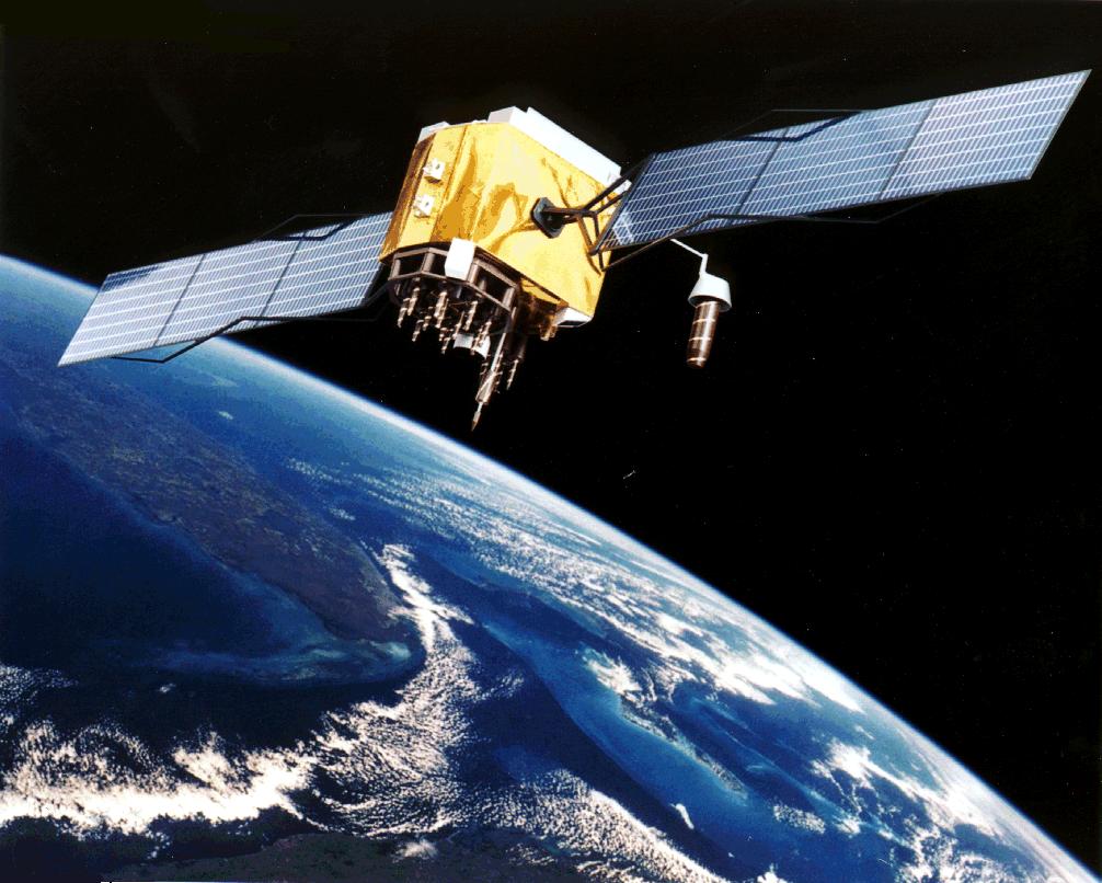
The Advent of Satellites: A New Era in Mapping
The launch of the Soviet Union’s Sputnik 1 in 1957 marked the beginning of the space age, demonstrating the potential for satellites to gather data from orbit. Recognizing this potential, the United States and other countries soon began launching their own satellites to study the Earth from above.
NASA quickly became a leading force in developing satellite-based Earth observation programs. The launch of TIROS-1 (Television InfraRed Observation Satellite) in 1960 was a milestone in satellite imaging, primarily used for weather monitoring.
However, it also laid the foundation for using satellite data in geographic analysis and cartography.
A major breakthrough came in 1972 with the launch of Landsat 1, the first in a series of Earth-observing satellites that provided detailed and consistent images of the planet’s surface.
The Landsat program, which continues today, has been instrumental in tracking land use changes, deforestation, urban expansion, and environmental changes. The ability to capture multispectral images allowed cartographers and scientists to analyze different aspects of the Earth's surface, from vegetation health to soil composition.
By the late 20th century, satellite mapping had become indispensable for various applications, including climate studies, disaster response, and resource management.
The introduction of GPS (Global Positioning System) in the 1980s, initially developed for military navigation, further revolutionized cartography by enabling real-time location tracking with unprecedented precision.
The Role of NASA in Advancing Satellite Mapping
NASA’s contributions to satellite mapping extend far beyond the Landsat program. Over the decades, the agency has launched numerous satellites designed to monitor Earth’s atmosphere, landforms, and oceans. Some of the most influential satellite missions include:
- Terra and Aqua: These Earth observation satellites provide vital data on climate, air quality, and environmental changes.
- ICESat and ICESat-2: These satellites are crucial for studying ice sheets, sea level rise, and topographical changes.
- GRACE (Gravity Recovery and Climate Experiment): Used for mapping variations in Earth’s gravity field, aiding in water resource management.
- MODIS (Moderate Resolution Imaging Spectroradiometer): Provides high-resolution images used in mapping deforestation, wildfires, and atmospheric conditions.
The Digital Age and Open Access to Satellite Data
The integration of satellite mapping into digital platforms has made geographic data more accessible than ever.
Services like Google Earth and MixPlaces, both of which incorporate NASA satellite imagery, have enabled the general public to explore the planet in extraordinary detail.
Open-source platforms such as NASA’s Earthdata and the United States Geological Survey (USGS) Earth Explorer provide free access to satellite imagery for researchers, businesses, and governments worldwide.
The transition from static maps to dynamic, real-time mapping has had profound implications across industries. From disaster management and environmental conservation to urban planning and agriculture, the ability to monitor and analyze the Earth's surface in real-time has made satellite mapping an indispensable tool in modern society.

Key NASA Satellite Missions in Cartography
NASA has played a pivotal role in shaping modern cartography through its satellite programs.
By providing high-resolution imagery, topographical data, and real-time environmental monitoring, these satellites have become essential tools for scientists, geographers, urban planners, and policymakers.
The Landsat Program: Revolutionizing Earth Observation
One of NASA's most influential contributions to cartography is the Landsat program, a series of satellites that have been capturing images of the Earth since 1972.
The Landsat 1 satellite, launched in collaboration with the U.S. Geological Survey (USGS), was the first dedicated Earth observation satellite designed to provide consistent, long-term data on land cover, vegetation, and urban development.
Since then, the Landsat program has evolved, with each generation of satellites improving upon the previous in terms of resolution, imaging capabilities, and data accessibility.
Landsat 8 and Landsat 9, the latest in the series, offer higher spectral resolution and greater coverage, allowing for detailed analysis of environmental changes, deforestation, glacier movement, and urban sprawl.
Landsat data has been instrumental in:
- Tracking land use changes over time, such as deforestation in the Amazon and urban expansion in megacities.
- Monitoring climate change effects, including the retreat of glaciers and rising sea levels.
- Providing detailed agricultural insights, such as soil moisture levels and crop health analysis.
With an extensive historical archive spanning over 50 years, Landsat provides one of the most valuable continuous Earth observation records available, making it a cornerstone of modern cartography.
Terra and Aqua Satellites: Advancements in Climate and Environmental Mapping
Launched in 1999, Terra is a flagship Earth observation satellite that provides comprehensive data on the planet's land, atmosphere, and oceans.
It carries multiple scientific instruments, including:
- MODIS (Moderate Resolution Imaging Spectroradiometer), which delivers near-daily global imagery at various resolutions, helping to monitor deforestation, wildfire activity, and changes in vegetation.
- ASTER (Advanced Spaceborne Thermal Emission and Reflection Radiometer), which provides high-resolution topographical data, crucial for mapping terrain and analyzing landforms.
Complementing Terra, the Aqua satellite (launched in 2002) focuses on studying the Earth's water systems, providing data on cloud cover, precipitation, and ocean temperatures.
Together, Terra and Aqua offer a holistic view of the Earth's environmental and climatic conditions, making them invaluable tools for modern cartography.
ICESat and ICESat-2: Mapping the Earth's Topography and Polar Regions
The Ice, Cloud, and Land Elevation Satellite (ICESat), launched in 2003, and its successor, ICESat-2 (2018), have revolutionized our understanding of the Earth's topography, particularly in polar regions.
These satellites use laser altimetry to precisely measure elevation changes in ice sheets, land surfaces, and vegetation canopy heights.
Key contributions of ICESat and ICESat-2 include:
- Monitoring ice sheet loss in Greenland and Antarctica, providing critical data on sea-level rise.
- Mapping forest canopies, aiding in biodiversity and carbon storage assessments.
- Improving digital elevation models (DEMs), which enhance the accuracy of terrain maps used in cartography.
Before these satellites, mapping polar regions was highly challenging due to harsh conditions and limited accessibility.
ICESat’s data has provided unparalleled insights into these remote landscapes, improving global elevation models and advancing our understanding of Earth's changing geography.
Global Positioning System (GPS) and NASA’s Role in Navigation Mapping
While the GPS is primarily a U.S. Department of Defense initiative, NASA has played a significant role in enhancing GPS-based mapping and navigation technologies.
GPS satellites, which orbit the Earth and provide real-time location data, have become an essential tool for cartographers, geographers, and everyday users.
NASA’s contributions to GPS mapping include:
- Developing precise geodetic positioning techniques that improve the accuracy of global maps.
- Enhancing earthquake and tectonic movement monitoring through GPS data integration.
- Supporting real-time tracking applications, such as Google Maps and GPS navigation systems.
GPS has revolutionized modern cartography by making location data widely accessible, influencing applications ranging from personal navigation to disaster response and environmental monitoring.
Other Notable NASA Satellite Missions Impacting Cartography
- GRACE (Gravity Recovery and Climate Experiment): Launched in 2002, GRACE and its successor, GRACE-FO, measure variations in Earth's gravity field, providing valuable data on groundwater storage, sea level changes, and ice mass fluctuations. These insights contribute to hydrological mapping and climate modeling.
- SMAP (Soil Moisture Active Passive): Launched in 2015, SMAP provides global soil moisture measurements, which are essential for agriculture, flood prediction, and drought monitoring.
- Sentinel-6 Michael Freilich: A collaboration between NASA and the European Space Agency (ESA), this satellite provides precise sea-level measurements, contributing to coastal and marine cartography.

Accuracy and Precision: A New Standard for Geographic Data
One of the most significant impacts of satellite mapping is the unparalleled accuracy it offers in geographical representation.
Prior to the advent of satellites, cartographers relied on ground surveys and aerial photography to map landscapes, a process that was time-consuming, expensive, and prone to human error.
Satellite imagery, particularly from high-resolution Earth observation satellites, has significantly improved the precision of maps, enabling geographers to capture minute details of the Earth’s surface.
For instance, NASA’s Landsat program provides multispectral imagery that can differentiate between land cover types, track urban expansion, and detect subtle environmental changes over time.
Similarly, ICESat-2 uses laser altimetry to measure elevation changes with remarkable accuracy, contributing to topographical mapping and disaster risk assessment.
This level of precision has profound implications for multiple fields, including urban planning, environmental conservation, and resource management.
Accessibility: Open-Source Data for Everyone
Another game-changing aspect of satellite mapping is the democratization of geographic data. Traditionally, detailed maps were limited to government agencies and specialized institutions due to the high cost of data collection and analysis.
However, NASA and other space agencies have made a vast amount of satellite imagery publicly accessible, fostering innovation across industries.
Platforms such as NASA’s Earthdata Portal, USGS’s Earth Explorer, and Google Earth allow researchers, businesses, and even individuals to leverage satellite imagery for their own projects.
These open-access resources have enabled small-scale enterprises, non-profits, and educational institutions to utilize cutting-edge cartographic tools that were once reserved for large organizations.
This accessibility has also expanded the role of citizen science, where individuals can contribute to mapping projects, disaster response efforts, and environmental monitoring by analyzing and validating satellite imagery.
Environmental Monitoring: Tracking Climate Change, Deforestation, and Natural Disasters
Perhaps one of the most critical contributions of satellite mapping to modern cartography is its role in environmental monitoring.
Climate change, deforestation, and extreme weather events require continuous observation, and satellite technology provides real-time data that aids in tracking these global challenges.
NASA’s Terra and Aqua satellites, equipped with MODIS sensors, monitor environmental changes such as:
- The melting of polar ice caps (using ICESat-2 data),
- Deforestation rates in the Amazon rainforest (through Landsat imagery),
- Wildfire activity and smoke dispersion,
- Changes in ocean temperatures and sea-level rise (via Sentinel-6 Michael Freilich satellite).
This data is crucial for policymakers and environmentalists working to mitigate climate change, enforce conservation policies, and prepare for natural disasters.
Early warning systems for hurricanes, droughts, and floods rely heavily on satellite mapping, providing life-saving information to vulnerable regions.
Urban Planning and Infrastructure Development
Cities worldwide rely on satellite mapping for urban planning, transportation networks, and infrastructure development. With global urbanization accelerating, accurate maps are essential for designing sustainable cities that accommodate growing populations.
- Landsat and commercial satellites help track urban sprawl, assisting city planners in optimizing land use and preventing overcrowding.
- GPS technology, initially developed with NASA’s support, has become indispensable for navigation, traffic management, and smart city initiatives.
- LiDAR data from satellites enables the creation of 3D maps of cities, improving construction planning and disaster preparedness.
Urban planners now use satellite-based Geographic Information Systems (GIS) to visualize city growth patterns, identify areas of congestion, and assess environmental impact before making major infrastructure decisions.
Agriculture and Resource Management: Ensuring Food and Water Security
The agricultural sector has greatly benefited from satellite mapping, as farmers and policymakers now have access to high-resolution images that allow them to monitor crop health, soil conditions, and water resources.
NASA’s SMAP (Soil Moisture Active Passive) satellite provides crucial data for:
- Drought prediction and mitigation,
- Precision farming techniques,
- Optimizing irrigation and water use,
- Monitoring desertification and land degradation.
With global food security becoming an increasing concern, satellite imagery helps agricultural scientists develop strategies to improve yields, reduce waste, and mitigate the effects of climate change on food production.
Disaster Management: Rapid Response and Damage Assessment
In disaster-prone areas, timely access to accurate maps can save lives. Satellite mapping has transformed disaster response efforts by providing real-time data on affected regions, allowing emergency responders to deploy resources effectively.
Key examples include:
- Hurricane tracking with NASA’s GOES (Geostationary Operational Environmental Satellite) system, enabling early warnings and evacuation planning.
- Earthquake damage assessment using high-resolution satellite imagery to identify collapsed buildings and infrastructure.
- Flood monitoring via Landsat and Sentinel satellites to map inundated areas and assist in relief efforts.
With real-time satellite updates, aid organizations and governments can make data-driven decisions that minimize casualties and accelerate recovery.
NASA’s Contributions: A Quick Conclusion
Satellite mapping has fundamentally reshaped modern cartography, making it more accurate, accessible, and versatile than ever before.
NASA’s contributions through programs like Landsat, Terra, ICESat, and GPS have provided humanity with an unprecedented ability to map and analyze the Earth in real-time.
From tracking deforestation to optimizing urban infrastructure, the impact of satellite technology on cartography extends far beyond traditional mapping.
As satellites continue to evolve, integrating AI and real-time analytics, the future of cartography will be even more dynamic, interactive, and essential to solving global challenges.

The Challenges and Limitations of Satellite Mapping
While satellite mapping has revolutionized modern cartography, offering unparalleled accuracy, accessibility, and real-time monitoring capabilities, it is not without its challenges.
The reliance on satellite technology for geographic data collection comes with a set of technical, ethical, and financial concerns that must be addressed to ensure its continued effectiveness.
Data Processing and Storage: The Big Data Challenge
One of the most significant challenges in satellite mapping is the sheer volume of data generated by Earth observation satellites.
NASA’s Landsat program alone produces hundreds of terabytes of imagery every year, while higher-resolution commercial satellites generate even larger datasets.
Processing, storing, and analyzing this vast amount of data requires substantial computational resources and sophisticated algorithms.
- High-resolution imagery can take up enormous storage space, making it difficult for researchers and organizations to manage and access large datasets.
- Data processing time can be lengthy, requiring advanced AI and machine learning models to automate classification and analysis.
- Cloud computing solutions like Google Earth Engine and NASA’s Earthdata Cloud are helping mitigate storage and accessibility issues, but these require significant infrastructure investments.
As the number of satellites in orbit continues to increase, the challenge of efficiently handling geospatial data will remain a major concern.
Future innovations in AI-driven automation and quantum computing may help optimize data processing, but for now, managing satellite-derived information remains a complex task.
The Cost of Satellite Deployment and Maintenance
Another critical limitation of satellite mapping is the high cost of satellite development, launch, and maintenance. Even with advancements in commercial spaceflight reducing launch expenses, designing, building, and operating satellites remains expensive.
- Development costs for Earth observation satellites can run into the hundreds of millions of dollars.
- Launch costs, though decreasing with private space companies like SpaceX, still require significant investment.
- Satellite lifespan is limited, with most satellites needing replacements or servicing within 5-15 years.
The financial burden of satellite technology makes it difficult for smaller nations and organizations to develop and operate their own Earth observation programs.
This has led to reliance on publicly available datasets from NASA, the European Space Agency (ESA), and commercial providers. While free and open-source satellite data initiatives have improved access, the cost of developing new technology remains a major barrier.
Ethical Concerns: Privacy and Surveillance Issues
One of the most controversial aspects of satellite mapping is its potential for privacy violations and mass surveillance.
High-resolution satellite imagery, capable of identifying individual objects and even people, has sparked ethical debates over the implications of global surveillance.
Key concerns include:
- Government and corporate surveillance: Some governments use satellite technology for intelligence gathering and surveillance, raising concerns about civil liberties.
- Commercial use of high-resolution imagery: Private companies like Google, Apple, and commercial satellite firms offer highly detailed mapping services, prompting concerns about how data is collected, stored, and shared.
- Lack of regulation: There are few international laws governing the ethical use of satellite imagery, particularly in terms of data privacy.
While satellite mapping has immense benefits for disaster response and environmental monitoring, it also raises fundamental questions about how much geospatial information should be publicly available and who controls access to it.
Atmospheric and Environmental Limitations
Despite the advanced imaging technology on board modern satellites, there are still environmental limitations that affect data accuracy.
- Cloud cover and atmospheric interference: Optical satellites struggle with cloud cover, which can obscure images and require additional data processing.
- Seasonal and lighting constraints: Some satellites rely on sunlight to capture images, meaning certain regions (e.g., the Arctic during winter) may not be well-mapped year-round.
- Resolution limitations: While commercial satellites now provide sub-meter resolution, many government-funded satellites offer lower resolution data, limiting their ability to capture fine details.
To overcome these challenges, synthetic aperture radar (SAR) satellites like NASA’s NISAR (upcoming) and ESA’s Sentinel-1 use radar imaging, which can penetrate clouds and provide consistent data regardless of weather conditions.
However, radar imagery requires more complex processing and interpretation compared to optical satellite images.
Orbital Congestion and Space Debris
The increasing number of satellites in Earth’s orbit has led to a growing problem: space debris.
As governments, private companies, and research institutions launch more satellites, the risk of collisions and orbital congestion has become a serious concern.
- As of 2025, over 8,000 active satellites are orbiting Earth, with thousands of defunct satellites and debris fragments also in orbit.
- Collisions between satellites can create hazardous debris fields that threaten operational spacecraft.
- Space traffic management is an emerging field aimed at preventing satellite collisions and ensuring the sustainability of Earth’s orbital environment.
Organizations such as NASA, ESA, and the United Nations are working on policies to regulate satellite launches and promote responsible disposal of defunct satellites.
The development of active debris removal systems is also being explored to help mitigate the risk of uncontrolled space junk.

Recap: Nasa, Satellite Mapping, & Modern Cartography
Satellite mapping has profoundly reshaped modern cartography, revolutionizing the way we observe, analyze, and understand the Earth's surface.
From NASA’s pioneering Landsat program to cutting-edge private sector innovations, the integration of satellite technology has transformed cartography into a dynamic, high-precision science that is accessible to researchers, governments, businesses, and individuals alike.
What was once a field reliant on labor-intensive ground surveys and limited aerial photography is now a real-time, automated process powered by high-resolution satellite imagery and hyperspectral imaging.
Today, cartographers and geospatial analysts can map environmental changes, track urban development, optimize agricultural practices, and even predict natural disasters with an accuracy that was unimaginable just a few decades ago.
NASA has played a pivotal role in advancing satellite mapping, launching some of the most significant Earth observation programs in history. Their missions have ensured that satellite cartography is not just about mapping static landscapes but about tracking the dynamic and ever-changing nature of the planet.
The wealth of freely available satellite data has empowered a new generation of researchers, policymakers, and citizens to contribute to global mapping efforts.
Whether aiding in scientific research, supporting humanitarian efforts, or shaping the cities of tomorrow, satellite mapping remains an essential technology that will define our relationship with the world for generations to come.